
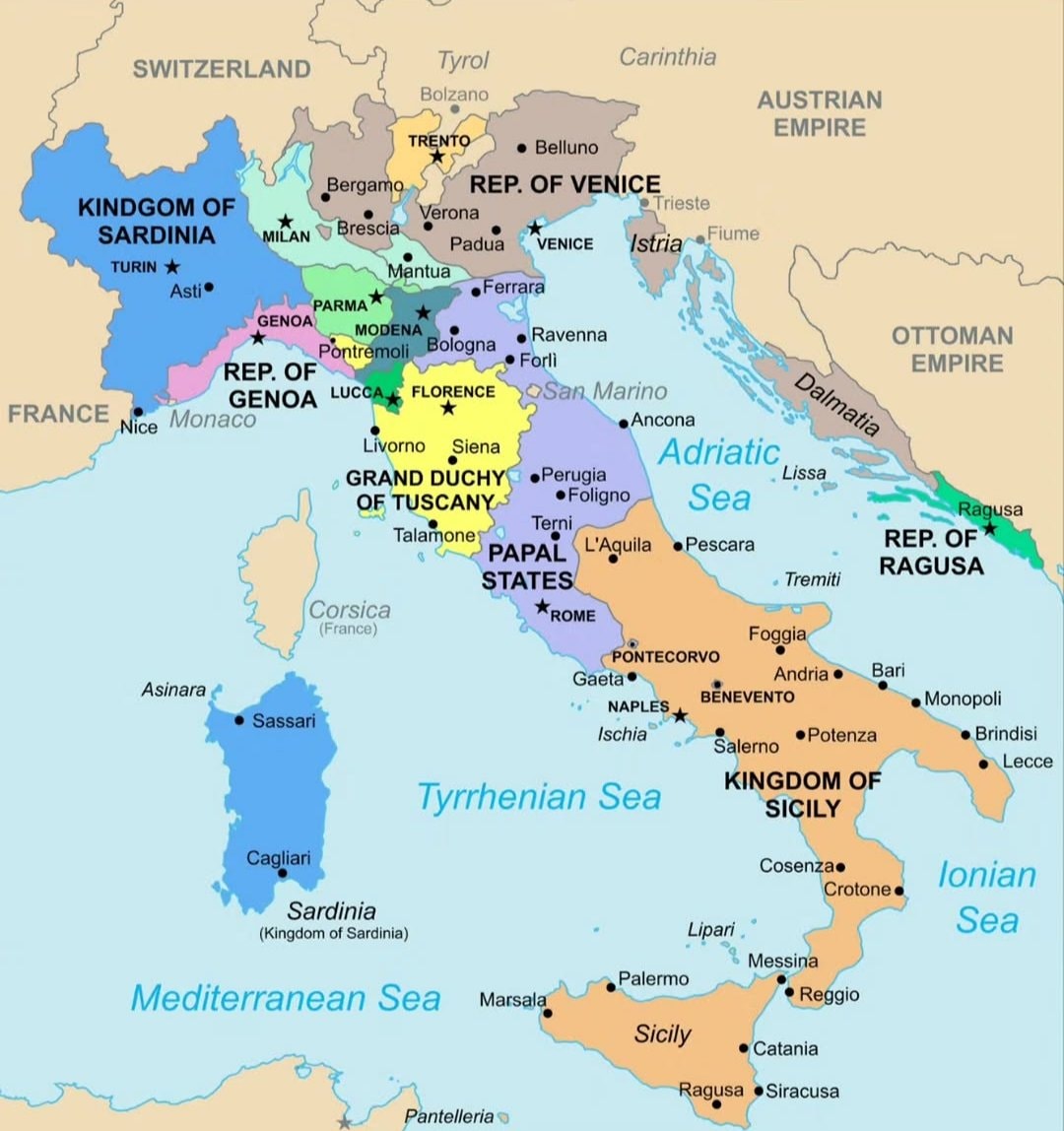
@scarlett_sItaly in 1796 🗺️ #InfoEditorials
Voir la publication d'origine@scarlett_sItaly in 1796 🗺️ #InfoEditorials
Voir la publication d'originePhoto de @scarlett_s· Sep 14, 2026· Info/Editorials
The image is a historical map of Italy. It shows various regions and kingdoms with their borders and names. The map is colorful and detailed, with a clear layout of geographical features and political divisions. The style is educational and informative, presenting a snapshot of Italy's political landscape at a specific historical period. Notable elements include the distinct colors used for each territory and the clear labeling of cities and bodies of water. ON-SCREEN TEXT: KINDGOM OF SARDINIA, FRANCE, SWITZERLAND, TYROL, CARINTHIA, AUSTRIAN EMPIRE, OTTOMAN EMPIRE, REP. OF VENICE, REP. OF GENOA, GRAND DUCHY OF TUSCANY, PAPAL STATES, KINGDOM OF SICILY, REP. OF RAGUSA, Corsica (France), Sardinia (Kingdom of Sardinia), Mediterranean Sea, Tyrrhenian Sea, Adriatic Sea, Ionian Sea.
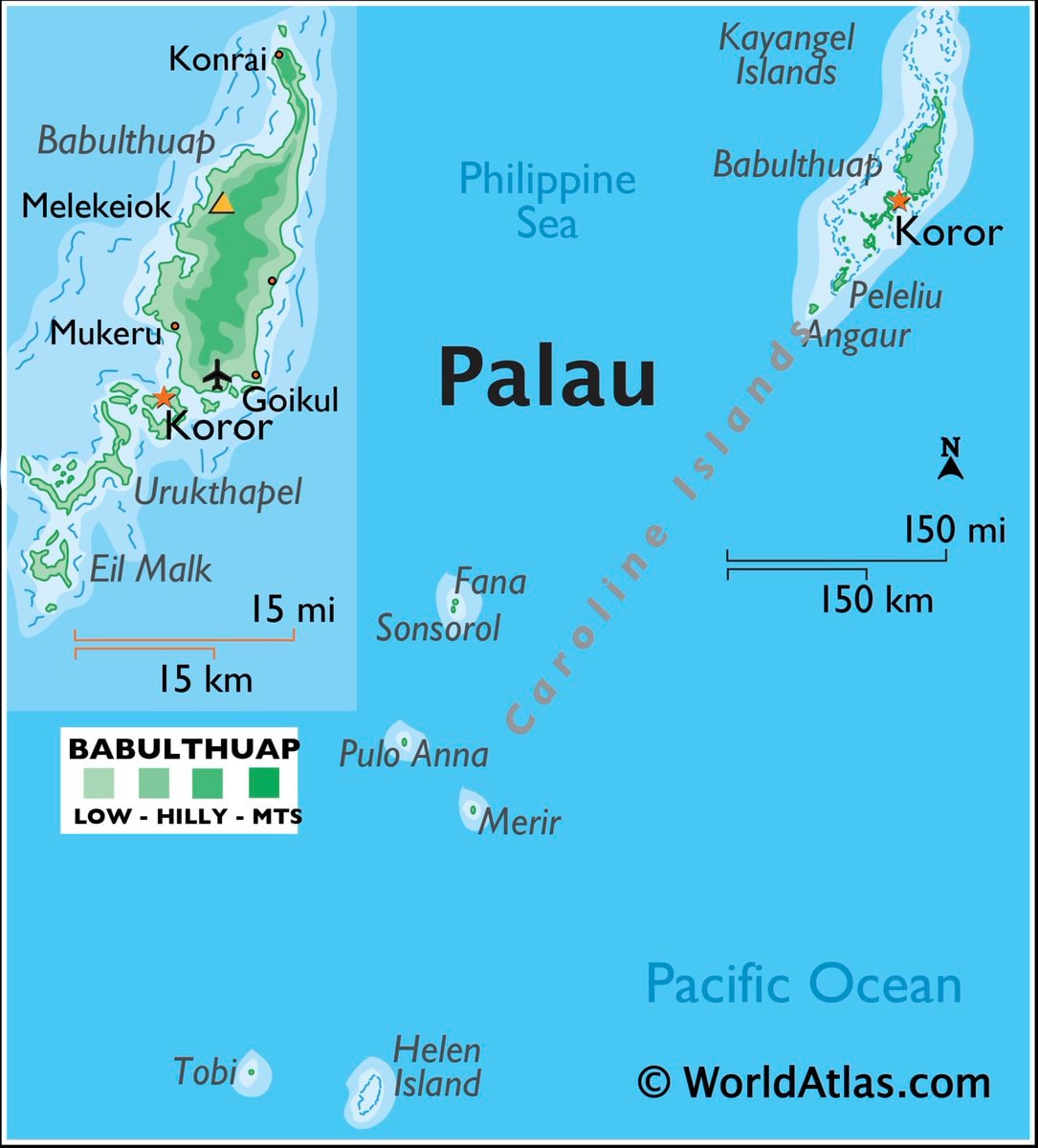 Palau map & facts
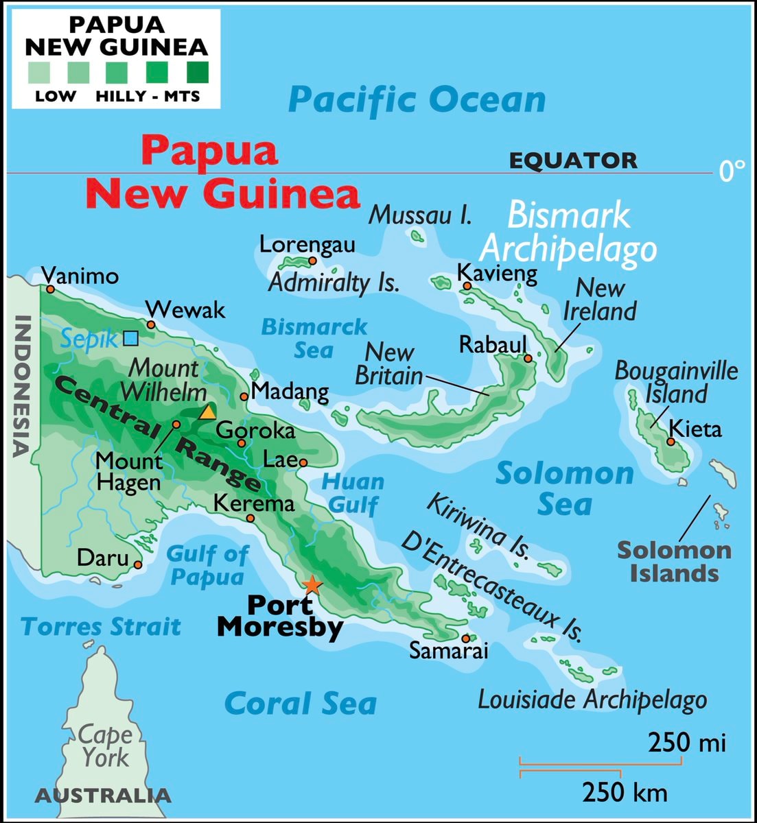 Papua New Guinea maps & facts
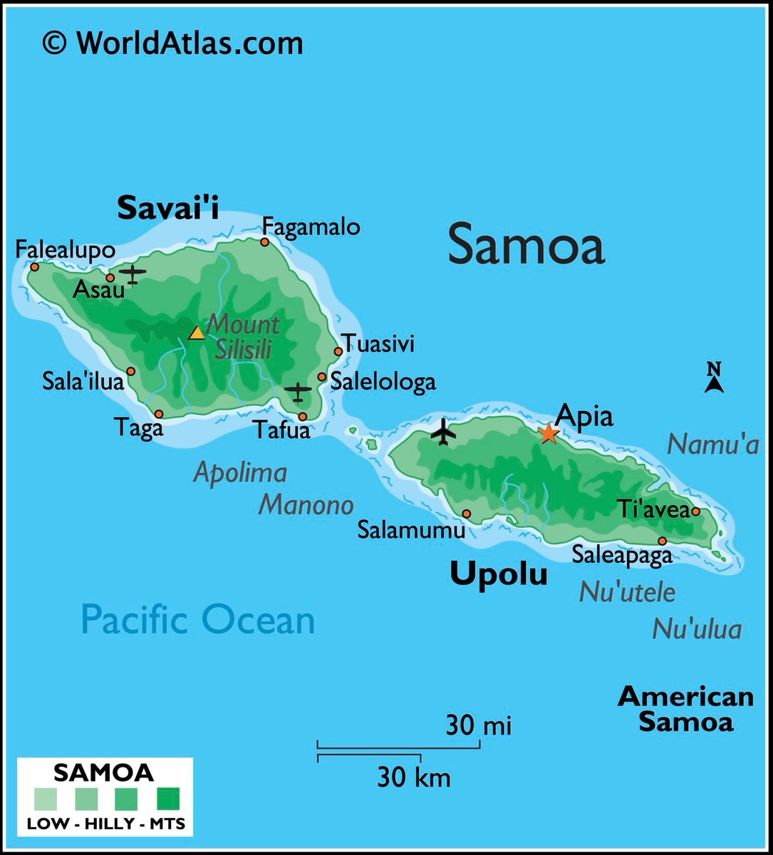 Samoa map and facts
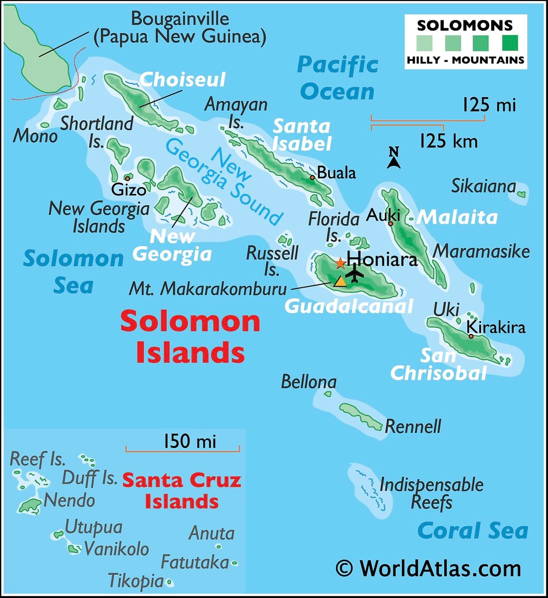 Solomon Islands map and facts
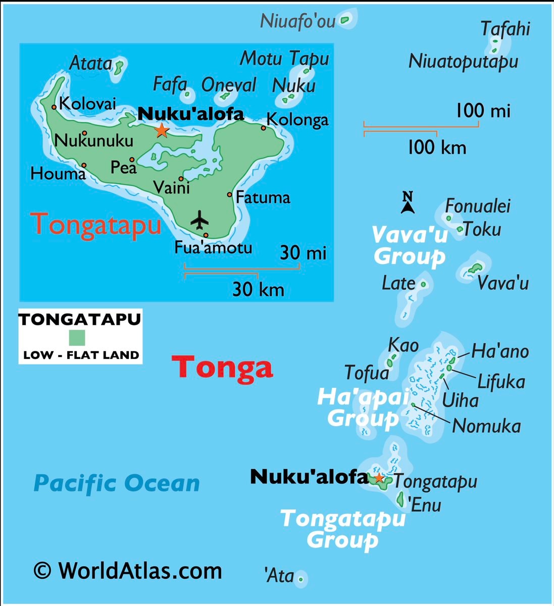 Tonga map and facts
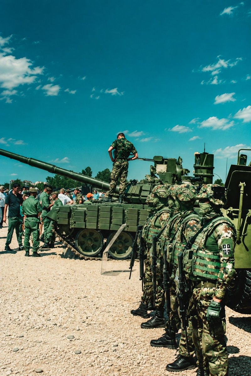 2Global willingness to fight for country
 Top 25 Most Famous People From Pakistan
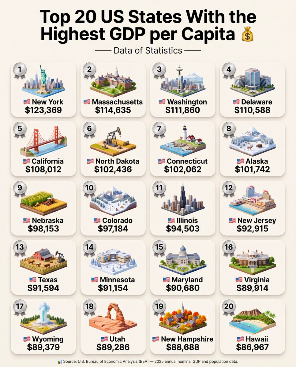 Top 20 US States Highest GDP per Capita
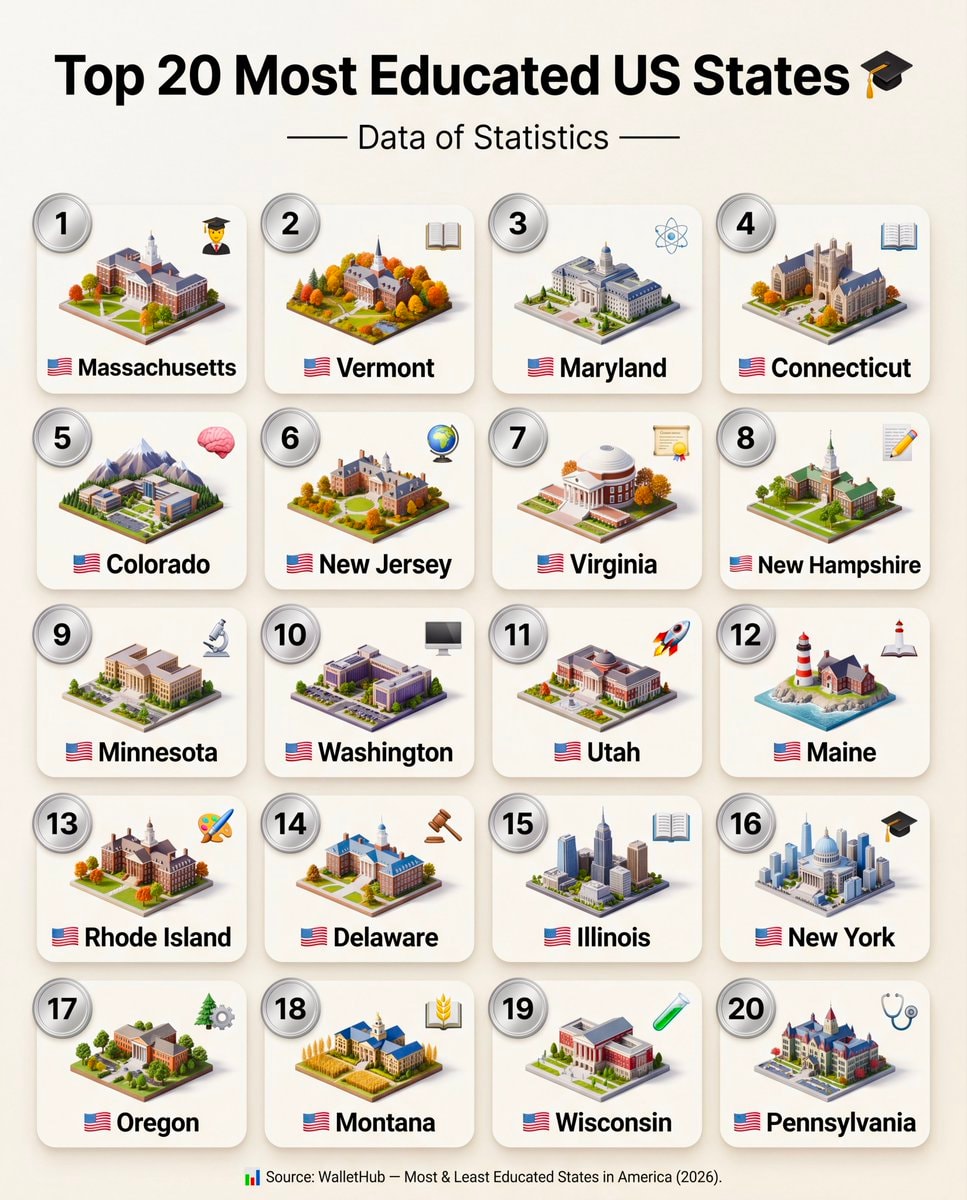 Top 20 Most Educated US States 2026
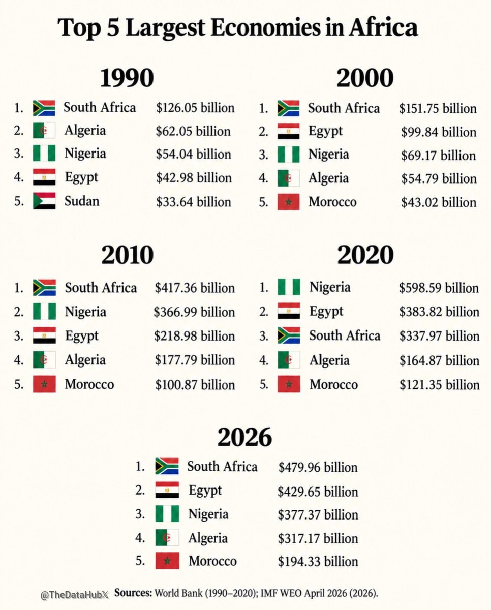 African economies ranking history
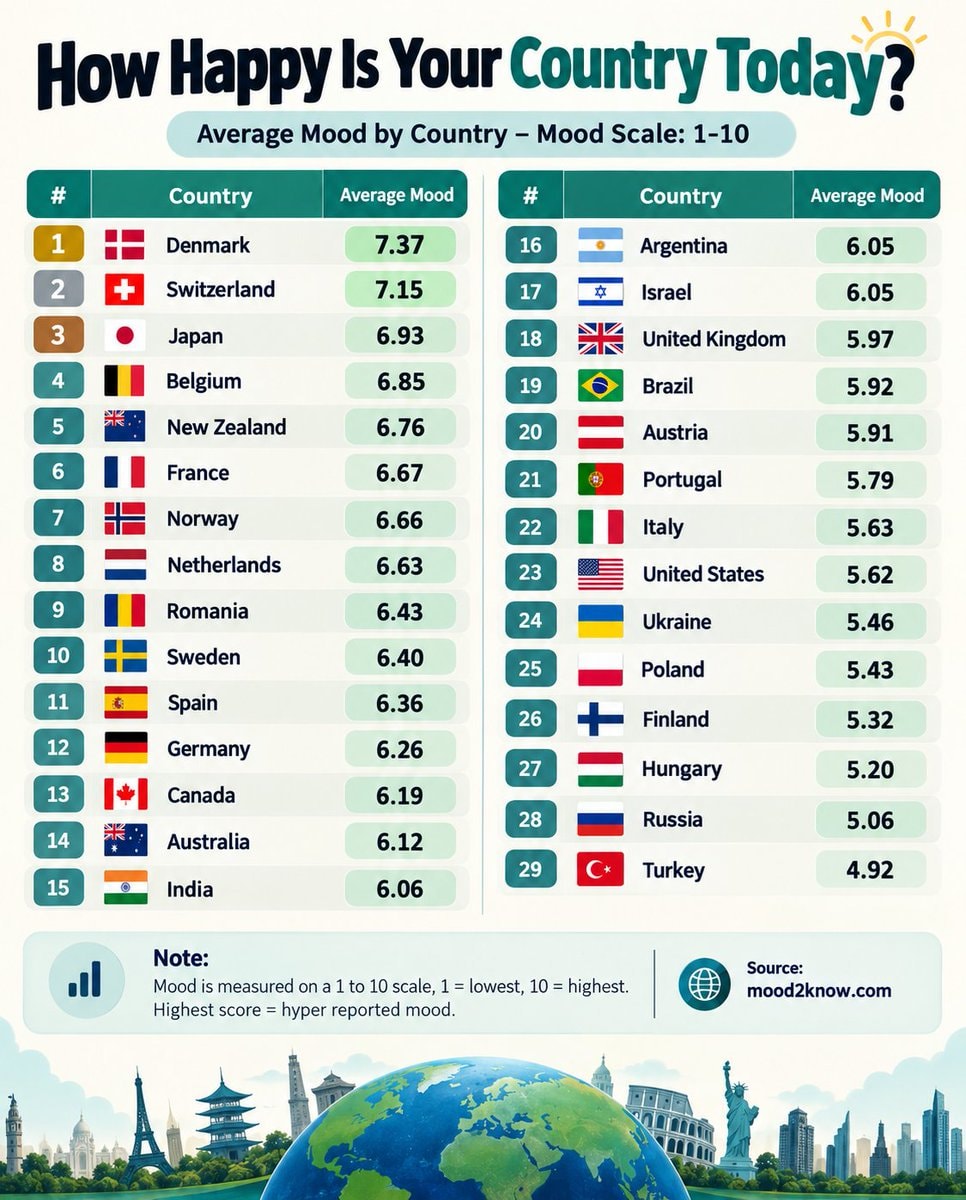 Countries ranked by average mood score
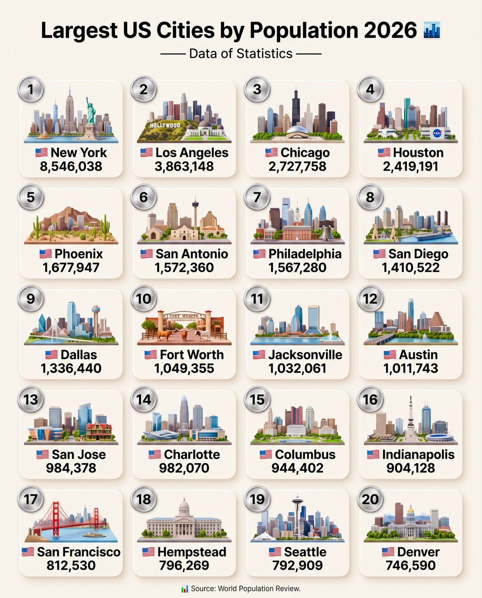 Top US Cities by Population 2026
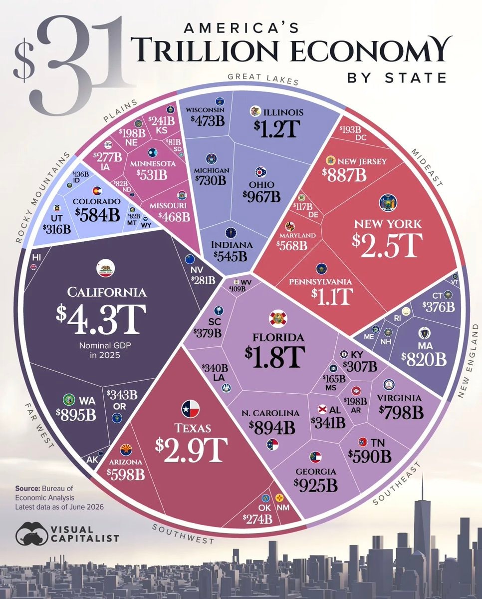 America state economy by GDP
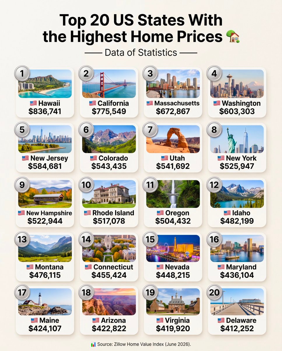 Top 20 US States Highest Home Prices
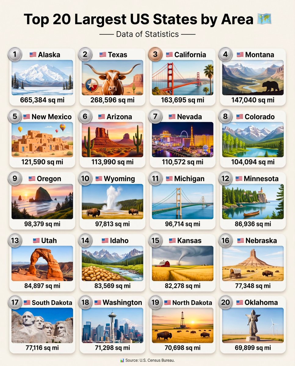 Top 20 Largest US States by Area
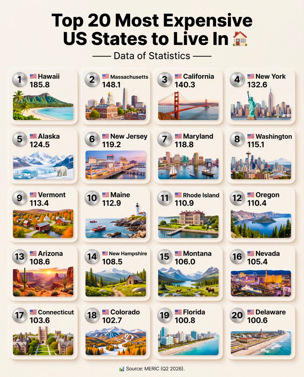 Top 20 Most Expensive US States to Live In
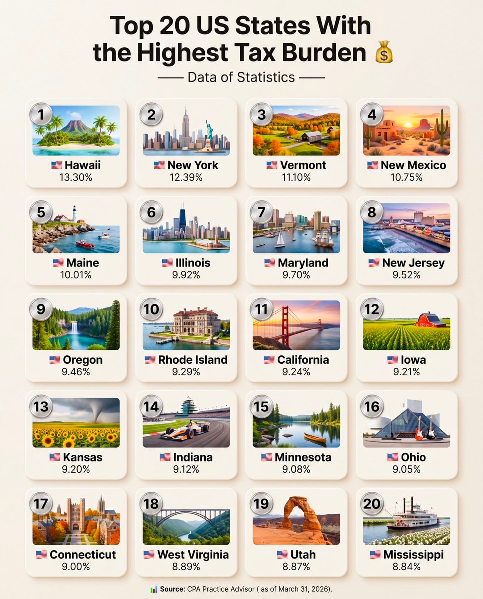 Top 20 US States With the Highest Tax Burden
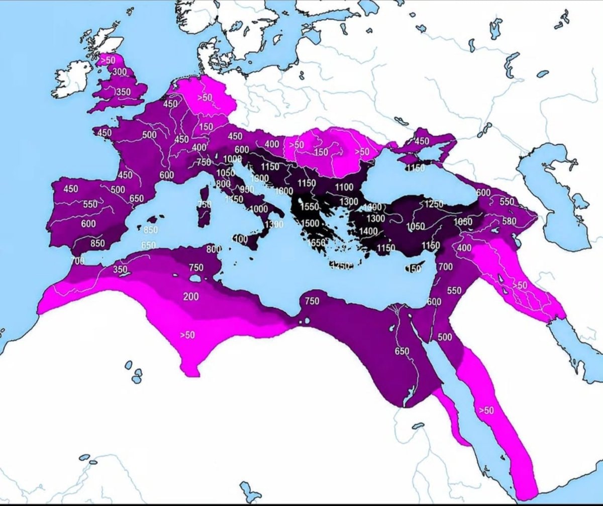 Roman Empire years of control by region
@scarlett_sItaly in 1796 🗺️ #InfoEditorials
Voir la publication d'originePhoto de @scarlett_s· Sep 14, 2026· Info/Editorials
The image is a historical map of Italy. It shows various regions and kingdoms with their borders and names. The map is colorful and detailed, with a clear layout of geographical features and political divisions. The style is educational and informative, presenting a snapshot of Italy's political landscape at a specific historical period. Notable elements include the distinct colors used for each territory and the clear labeling of cities and bodies of water. ON-SCREEN TEXT: KINDGOM OF SARDINIA, FRANCE, SWITZERLAND, TYROL, CARINTHIA, AUSTRIAN EMPIRE, OTTOMAN EMPIRE, REP. OF VENICE, REP. OF GENOA, GRAND DUCHY OF TUSCANY, PAPAL STATES, KINGDOM OF SICILY, REP. OF RAGUSA, Corsica (France), Sardinia (Kingdom of Sardinia), Mediterranean Sea, Tyrrhenian Sea, Adriatic Sea, Ionian Sea.
Aucun commentaire pour le moment. Soyez le premier !
Palau map & factsPapua New Guinea maps & factsSamoa map and factsSolomon Islands map and factsTonga map and facts2Global willingness to fight for countryTop 25 Most Famous People From PakistanTop 20 US States Highest GDP per CapitaTop 20 Most Educated US States 2026African economies ranking historyCountries ranked by average mood scoreTop US Cities by Population 2026America state economy by GDPTop 20 US States Highest Home PricesTop 20 Largest US States by AreaTop 20 Most Expensive US States to Live InTop 20 US States With the Highest Tax BurdenRoman Empire years of control by region
Aucun commentaire pour le moment. Soyez le premier !